3 days Exploring Southern California’s Hot Springs
categories: California Deserts, Southern CaliforniaI have a true passion for hot springs. Each has its own unique flavor and mineral content. Thankfully, I live in the Ring of Fire, with old volcanoes where hot water from underground finds its way to the surface in dozens of hot springs. I had spent a good bit of time in northern California’s hot springs, so now it was time to head south.
I pulled out my trusty map of geothermal springs from the National Oceanic and Atmospheric Administration (commonly known as NOAA) and zoomed into southern California. (Don’t ask me why an organization focused on weather and oceans makes a map of hot springs). After realizing there are dozens of hot springs – and I only have a few days to explore – I started to cross them off my list.
Table of contents: ()
Day One
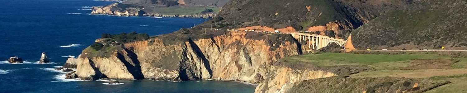
The first day was spent along the coast between San Luis Obispo and Los Angeles. The closest spot is Gaviota Beach, but there are plenty of pull-offs along Highway 101 to explore. Note there aren’t many places to get food around here, so if you take a longer hike, pick up food in Santa Maria or Santa Barbara.
Gaviota Hot Springs
The first hot springs for this trip were tucked away in the hills of Gaviota State Park, a beautiful landscape that includes trails from Gaviota Peak (2,458 feet in elevation) to the beach, where you can camp and hear the waves crash as you fall asleep.
The park itself has an extensive trail system and even connects to Los Padres National Forest, but the hot springs are only 0.7 miles from the parking lot. And the parking lot is right off of Highway 101. I parked my car in the lot along Highway 101 – the proximity gave me pause about my car getting broken into. So, I suggest taking your valuables or hiding them out of sight.
I suggest taking a photo of the park map in the parking lot because there are two ways to the hot springs – one longer than the other. The easiest is hiking up the main fire road and turning left onto Trespass Trail. You’ll then find a creek on your right that you can follow up to the source – Gaviota Hot Springs.
I took the easy hike up to the springs. On the way up there are beautiful views of the rolling hills of southern California – making this a great spot to hike during sunrise or sunset.
I had high expectations for this spring because I had been trained by the Instagram goddesses that it would have a beautiful, milky blue look and would feel like diving into a pool of whipped cream. Let’s all just note here, that the use of filters on Instagram is extensive.
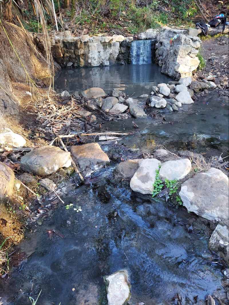
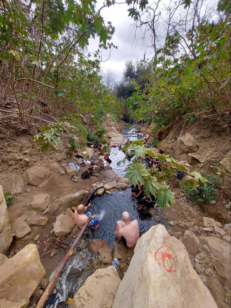
Getting to the top of the hill to see the springs, I noticed they were nearly full. There are two springs – one more rustic with a small waterfall of hot water feeding it and the lower spring that was built with rock walls that receive water from the first one. Most folks were vying for the first hot springs.
I squeezed my way into the first one and felt the warmth relax me a bit. The water is warm, but I wouldn’t call it hot. It’s also a bit more the color of water after it passes through the laundry machine. The second pool was definitely cooler since it didn’t get water directly from underground.
I enjoyed the springs but would definitely suggest early morning if you want to beat the crowds. Plus, you can then add on the 6-mile hike to Gaviota Peak where you can get amazing views of the coast, or to the Gaviota Wind Caves, a steep 4-mile hike where you can explore a number of caves overlooking the coast.
Montecito Hot Springs
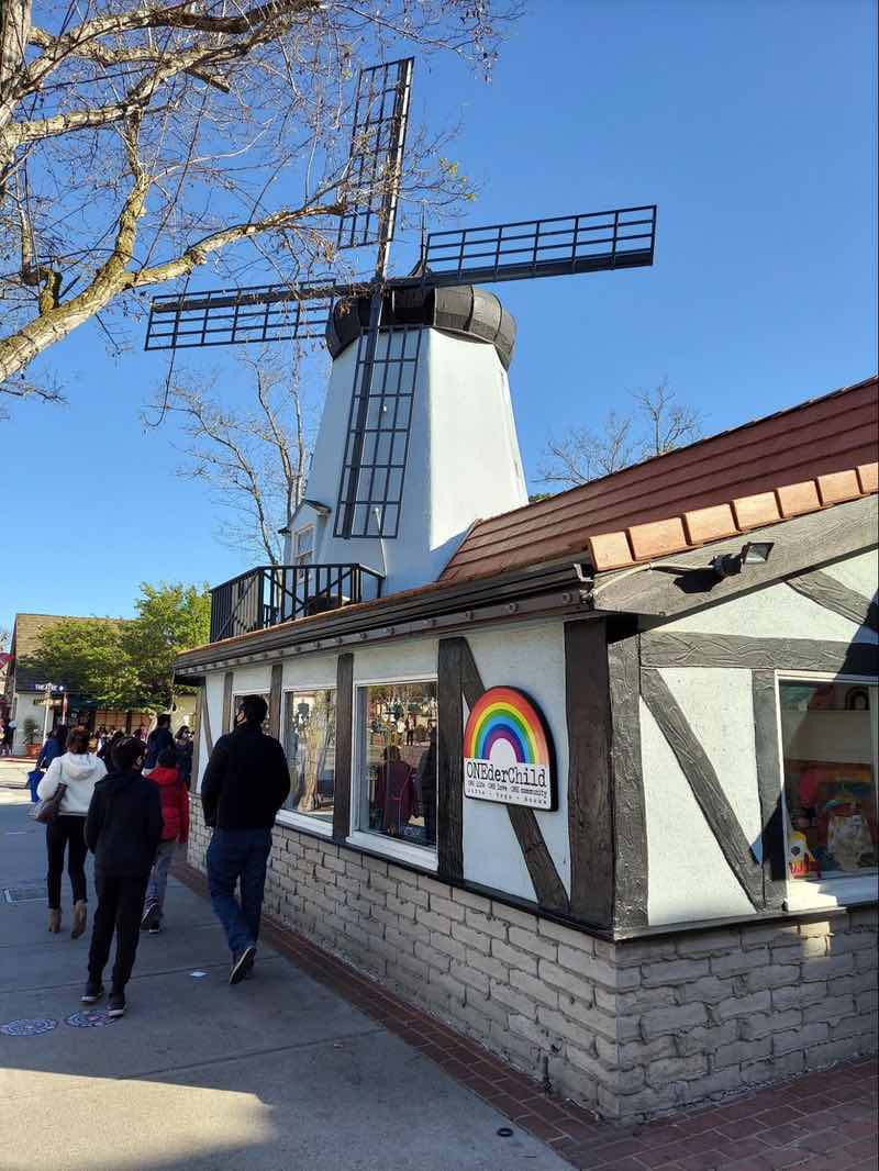
Rather than taking these hikes, I opened my map back up to see what I had time for. To my surprise, I realized I was close to Solvang, a cute little Danish town with windmills, flower boxes, and authentic Danish pastries. I knew I wasn’t dressed for it, but threw caution into the wind and drove the 20 minutes to visit.
I parked, and walked through the main part of town, admiring the windmills. If you don’t want to be around people, I suggest skipping Solvang because it is very busy! After eating Aebleskivers, a tennis ball-shaped piece of fried dough with powdered sugar and raspberry sauce, I meandered back to my car. The Red Viking Restaurant offers this treat along with some other Viking delicacies like pickled herring and liver pate.
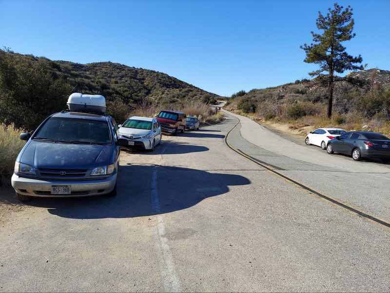
Next stop, Montecito Hot Springs – about an hour’s drive south. I knew from my research that parking might be challenging. To get to this hot spring, you will have to park in a residential neighborhood with multi-million dollar homes and potentially battle with springgoers and homeowners alike.
Parking is challenging but I was lucky enough to arrive just as someone was leaving. If you are going, get there early before 8 am.
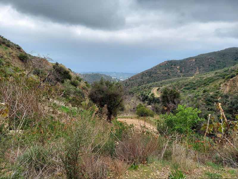
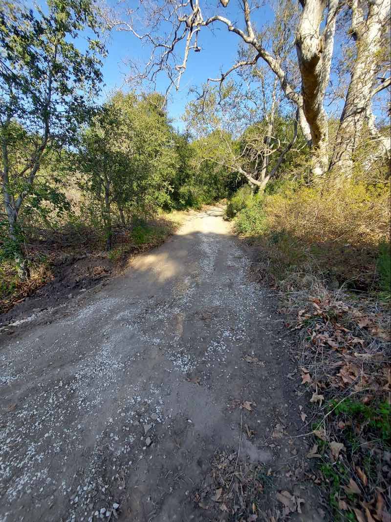
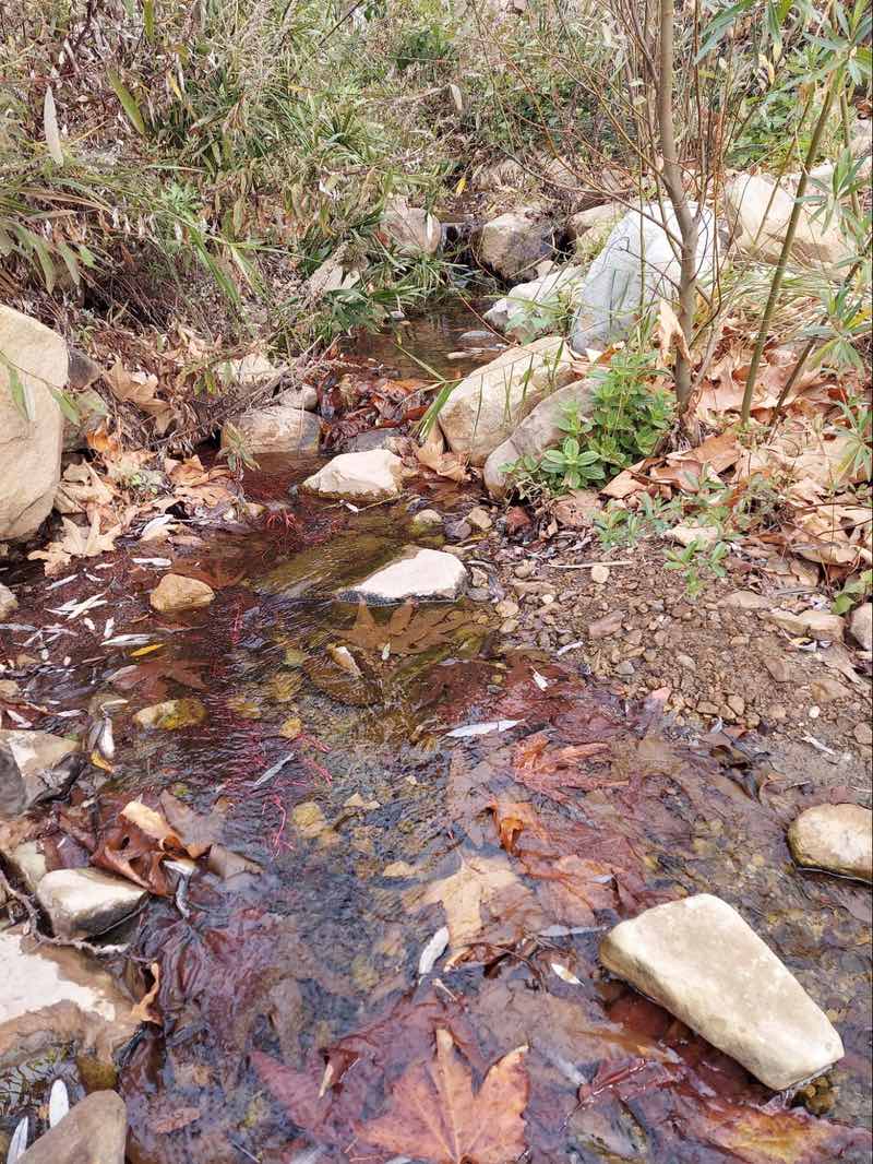
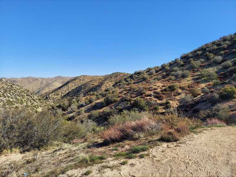
To get to the springs you’ll take a 2.5 mile well-maintained dirt path. You are walking near the creek that goes to the hot springs for most of the hike. The first part of the hike is next to homes, then it slowly transitions to shrubs and boulders, the typical southern California landscape.
It was spring, so flowers were in bloom and I definitely stopped to admire the yellows and purples. There isn’t much shade so bring a hat and lots of water because there isn’t water available to drink on the hike.
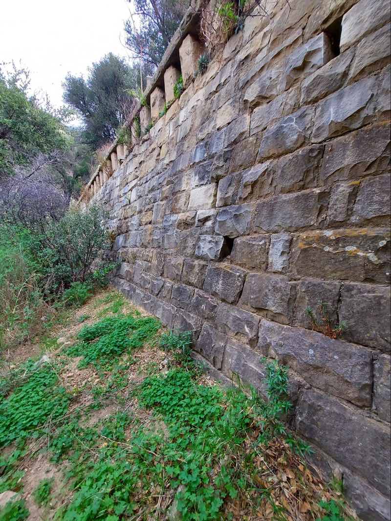
As you get closer to the hot springs, you’ll come across the ruins of an old building – a former hot springs resort. At this point, the turnoff to the springs will be on your left.
- Search for Great Tours HERE
- Log your park visits with a Passport To Your National Parks
- Get a Car Rental
- Save on tickets to Southern California’s famous theme parks with a SoCal CityPass
- Book Your Accommodation HERE
- Buy Travel Insurance
It was hard to miss the hot springs because it was packed! Luckily there are seven large pools cascading down the hill. I walked past a number of families, some playing music, and found a spot large enough for me to sit down.
As I enjoyed the warm water, the person next to me began to dig up clay from the bottom of the pool and rub it onto his face, creating a milky gray layer of mud. He shared that he had been doing this for years and a few of us followed suit. Between the warmer, 112 F temperature and the clay, this was ranked higher than Gaviota for me.
I didn’t get a chance to try out the other six pools because they were full, one with a bachelorette party, so I would highly recommend an early morning visit to beat the crowds. The nice thing about the springs is that they are mostly shaded.
I also learned that a destructive mudslide in 2018 had sent mud and boulders plowing down the Santa Barbara hillsides and caught the hillsides on fire as they ruptured a gas main. The mudslide had changed the look and feel of the springs as well, making the pools smaller.
Day Two
After getting some sleep in a chain hotel, I started my trek over to Deep Creek Hot Springs. I knew it was a three-hour drive to the trailhead so made sure to leave early. Plus I knew I might hit some traffic as I traversed northern Los Angeles.
I shot across 101 and then 210 going east, hitting some morning traffic, but not as bad as it could have been. I’ve driven in Bay Area California and Washington, D.C. traffic my entire life, so I have adapted a bit.
As you pass through Agoura Hills on Highway 101 look for a huge overcrossing without cars. The largest wildlife crossing in the U.S. is built there to help mountain lions cross the road.
If you have time, you can also take a quick stop off at the Hollywood Sign and Los Angeles Zoo. Instead, I took 18 North to explore the Rim of the World Scenic Drive on my way to Route 173 East. I was surprisingly blessed with snow showers, though the narrow roads and forest of pine trees forced me to pay close attention.
Deep Creek Hot Springs
Now, I had done my research on the best way to get to the hot springs. There were two ways – an extremely steep six-mile hike on the Pacific Crest Trail (from Arrowhead Lake Road) or a 2.5-mile hike from Bowen Ranch Road, entering from private land.
Oh and by the way the guy who owns the private land charges a fee and wields a gun. Suffice it to say, I like adventure and don’t enjoy conflict, so I hiked the six miles.
The springs are part of the San Bernardino National Forest and the creek is a state-designated Wild Trout Stream if you enjoy fishing. This told me the water is clean.
I parked along Arrowhead Lake Road, along with a dozen or so other cars, and found my way to the trailhead. I highly recommend not doing this hike in the summer unless you have experience with arid places. I packed up a couple of gallons of water and my lunch and began.
At first, the hike was a beautiful, relatively flat path through a valley of shrubs and a dry creek bed. About halfway through that shifted and the path quickly descended.
I have a good bit of hiking experience and have hiking boots, but the steepness of the path forced me to crawl like a crab and in some places grab onto wobbly shrubs in hopes that they would prevent me from tumbling down the hill. At this point, I questioned whether I should have faced up to the guy with the gun.
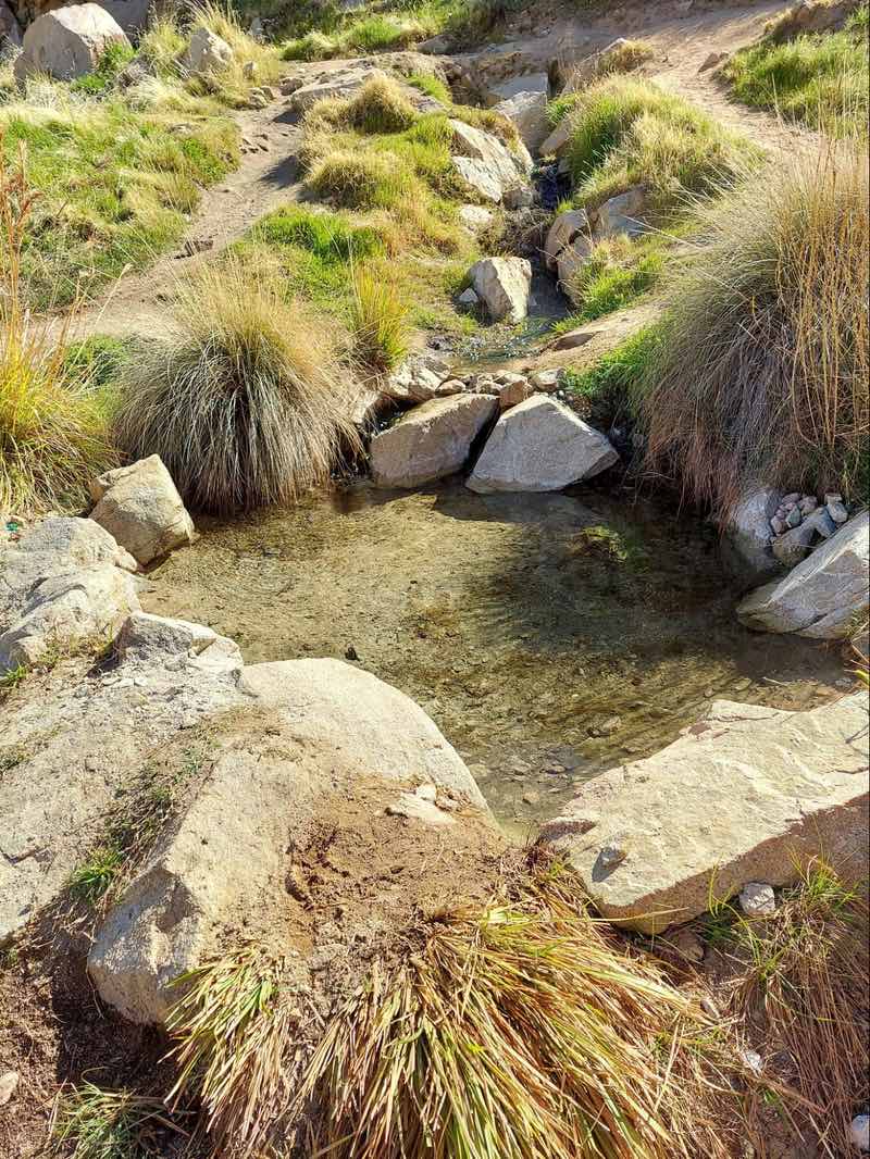
For the last third of the hike, the trail flattened out again and I was able to see the green valley along Deep Creek. The trail to find the springs is well-used. I saw the first little hot spring, just big enough to fit a person as the trail turned to the left towards the Creek. I dipped my toe in it and realized, much like Goldilocks that this spring was too hot!
After following the trail for five more minutes I came into an open area where folks were camping. There is a potable water spigot there and I learned from one of the campers there that it has lithium, a mineral common in this hot spring, and one that was used to treat depression in the past. I took a risk and refilled my water bottle.
I can’t say if it was the water or making it to the hot springs but I felt pretty happy the rest of the day.
I then explored the other springs. There are about five springs along the creek, which is more like a river. As I approached the river, there was a pool in the boulders that could hold about four people – this one was only lukewarm, too cool for me.
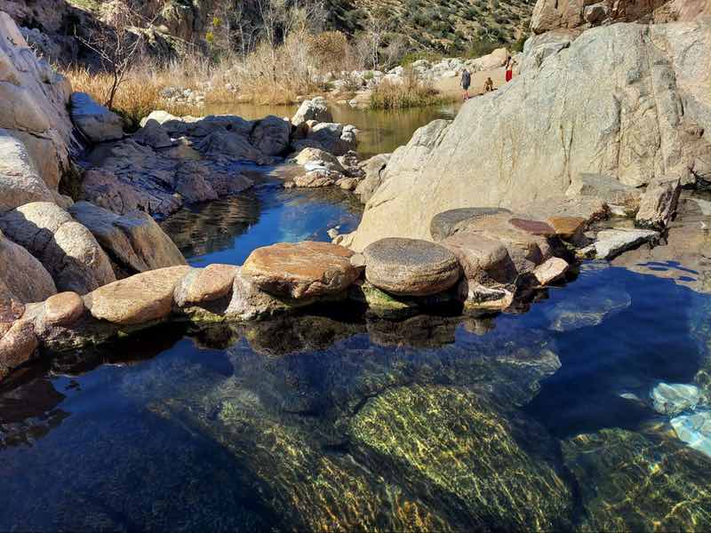
I maneuvered over a number of boulders and around the corner to find a larger pool overlooking the river. Hot spring water was flowing over the boulders into these pools. As I sat down, the heat permeated my sore muscles and I knew this was just right. I spent a couple of hours in these springs, hearing about the value of NFTs from a group of Los Angeles locals, then dipping my feet in the cool water of the creek while eating lunch.
Luckily the trip back to the car was not as difficult, as the trail was now uphill. But I was definitely tired once I got safely back to my car.
If you don’t like crowds I would definitely recommend this spring over the others in this article. As usual, though you’ll have to put in some effort to get space to yourself.
Day Three
After getting some rest, I stocked up on a few gallons of water, as I was now headed into the desert. Now the challenge with finding hot springs in the desert is that many of the roads that lead to free hot springs are sand and rock – not very kind to my Hyundai Elantra (more on that later).
If you are open to paying an entrance fee, there are a number of hot spring resorts such as Wonder Valley Hot Springs, Mi Kasa Hot Spring (Adults Only, Clothing Optional), and El Morocco Inn and Spa.
On my way to my campsite at Joshua Tree National Park, I unsuccessfully searched for a few of the desert oases I had bookmarked.
On the way was the Zzyzx Spring. In the 1940s it had been operated as the Zzyzx Mineral Springs and Health Resort with a two-story castle, a dining hall, a library, a lecture room, a pool house, a goat farm, and rabbit rooms. It closed down and California State University took over the facility in 1976, and now operates a Desert Studies Center there. So, sadly no springs to explore or magical healing waters.
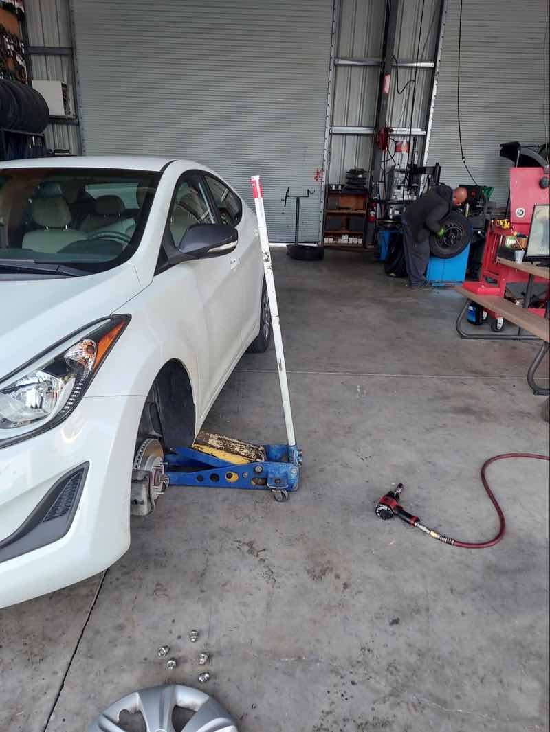
Sadly I turned onto the wrong road while coming back and ended up on those sandy roads I mentioned. I didn’t get stuck but noticed a distinct slapping noise under my car – ugh a flat tire. Only one place nearby was open, so I wandered over to Baker.
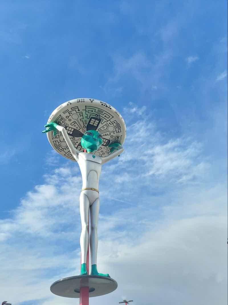
The little town of Baker doesn’t have much outside a car repair shop. But to my surprise, I found where the aliens had landed after leaving Area 51 – the Alien jerky store. Believe me, you will not miss this store that’s shaped like a UFO with an alien that’s at least 3 stories high outside. I bought a few bags of alien jerky to give my kids and got back on the road. Note, the jerky may be more of a novelty versus a delicacy.
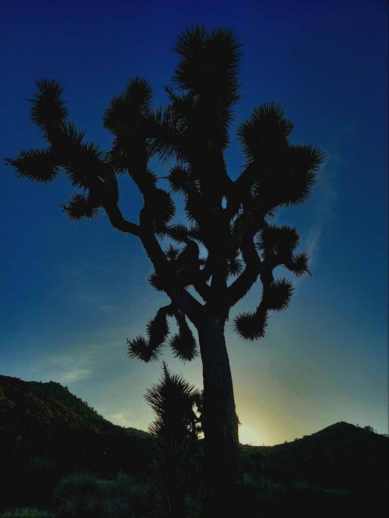
Arriving at my campsite at Joshua Tree a little late was fine. The weather was cooling down and I had beautiful views of the Joshua Trees and cactus as the sunset, making the edges glow. The night was fairly uneventful and quiet, though I did worry about an alien invasion, especially since I now had alien meat in my possession.
I camped at Black Rock Campground, an easy-to-access campground off Twentynine Palms Road and the start of the park. It’s the perfect place to start your trek at Joshua Tree and is full of the park’s namesake, Joshua Trees. There is an easy walking path onsite and clean bathrooms.
Day Four
Knowing my tire was in good shape, I wandered Joshua Tree National Park a bit in search of the desert tortoise.
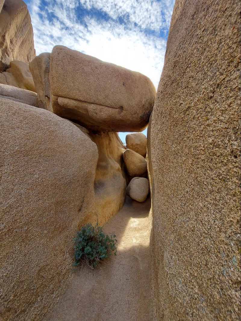
While looking for the tortoises, I wanted to enjoy the unique geology of the park. One of the best trails for this is the Hidden Valley Trail, a short one-mile trail. Between the late 1800s and early 1900s, the valley was used by cattle rustlers looking to stay “hidden”. If you are adventurous this trail, and many other places in the park, are popular for bouldering and rock climbing.
Another unique trail is the Hall of Horrors. This trail is great if you want to get fun shots of being inside of a slot canyon but don’t want to boulder or take a long hike. The hike is only a mile over relatively flat elevation. Hall of Horrors is on the north side of Park Boulevard, just west of the Ryan Mountain trailhead and Sheep Pass.
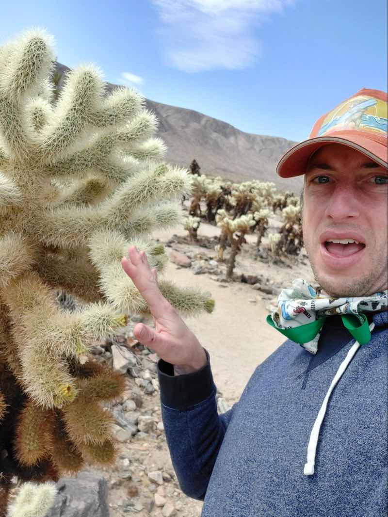
As I left the park, I saw the Cholla Cactus garden on the map and had to stop. I had seen one of these cacti at my campground. Pulling into the park was nothing I had seen before – a field of these teddy bear cacti – 10 acres of them.
The walk itself is an easy half-mile path on a boardwalk. When the cacti die they leave a beautiful hollow wooden log. But one thing you shouldn’t do is touch the cactus. They can easily bury their spines deep into your skin and even go through the sole of your shoe. Sadly, the “teddy bear” name is misleading.
While it was sad to leave this unique and beautiful place, I had to make it back home. What I do know is that I could spend another month or so exploring the local hot springs. Maybe next time I will splurge and even try some of the resorts.

 Joshua Tree Rock Climbing – Rock Climber’s Guide to Joshua Tree National Park
 Death Valley National Park – Amateur Traveler Video #77
 A Summer Journey to Death Valley National Park
by Marcus Griswold
Marcus Griswold is a hot springs enthusiast and ecologist. His blog, Hot Spring Journeys brings to life the magic and beauty of hot springs across the world.One Response to “3 days Exploring Southern California’s Hot Springs”
Leave a Reply
Tags: hiking, hot springs, joshua tree national park, national park


Sunny
Says:July 20th, 2024 at 5:50 am
This looks amazing to read about santa barbara