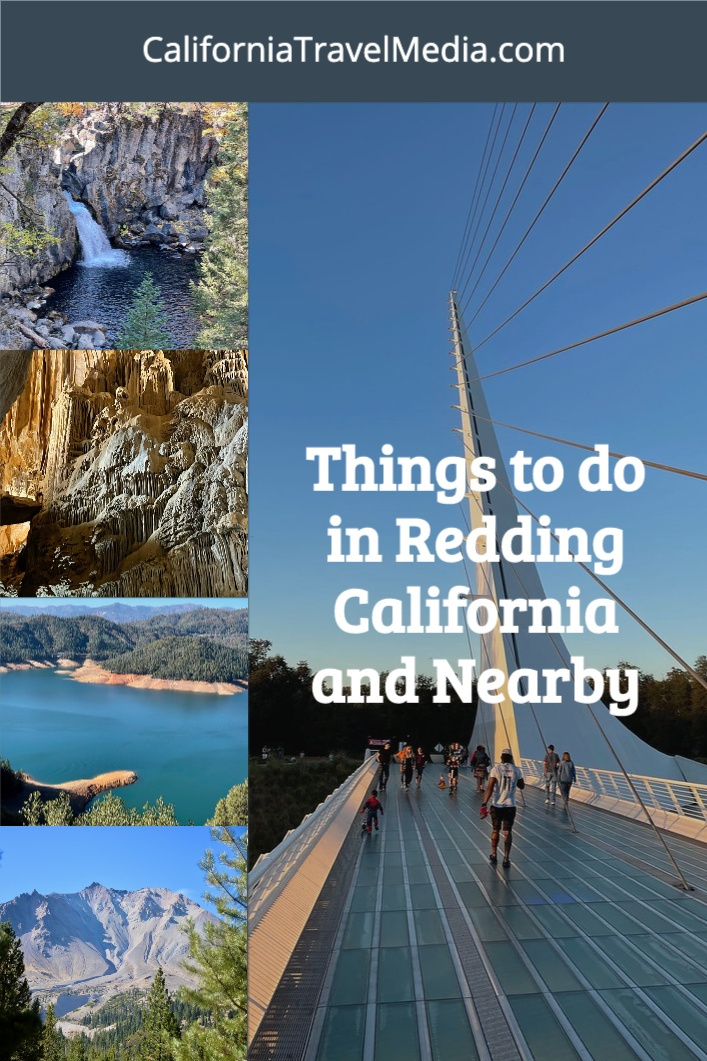
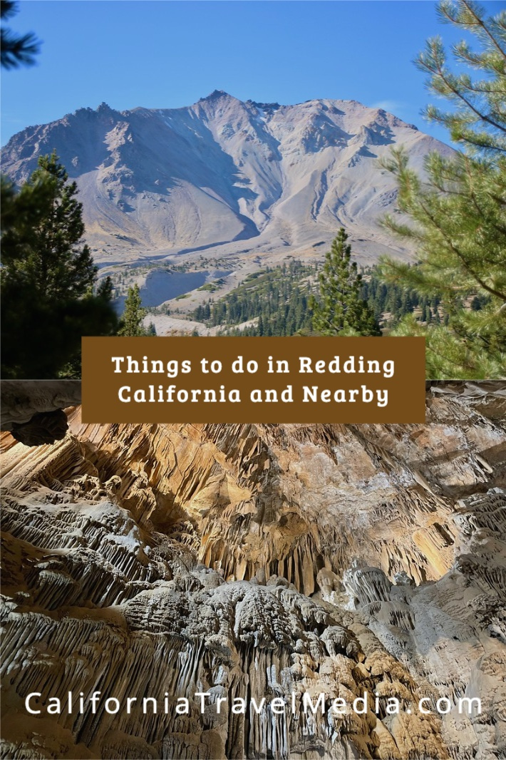
Things to do in Redding California and Nearby – Lassen Volcanic NP, Shasta Lake Caverns, 5 Waterfall Loop
categories: Northern CaliforniaIf I told you that I just got back from a three-day trip that included 2 volcanoes, 5 waterfalls, and a cave, you might think I had been someplace exotic like an island in the South Pacific. But instead, I visited Northern California, one of the lesser-known national parks, and the region around Redding.

Lake Shasta Caverns
Table of contents: ()

When to Visit Redding
We made our home base in Redding California which is at the northern end of the Sacramento Valley (half of the Central Valley). Timing is a little tricky in terms of the best time to visit Lassen Volcanic National Park because the Central Valley is quite warm in summer but parts of Lassen can be snowed in from winter through early summer. When I visited as a child, our trip was in June and I recall my 6′ tall dad standing in front of snowdrifts that were twice his height. We traveled at the end of October and had nearly perfect weather. Redding had highs in the 70s and 80s and Lassen which is nearly 7,000 feet higher was cool but comfortable. The only disadvantage with October is that the days are starting to get shorter.

Day One – Lassen Volcanic National Park
If you’re not familiar with Lassen Volcanic National Park, this park started with a bang. After laying dormant for 27,000 years, the volcano Mount Lassen started erupting in 1914. After 11 months of steam explosions, on the evening of May 14, 1915, the mountain exploded. Chunks of rock were thrown for miles and glowing hot rocks could be seen from as far as 20 miles away.
Lassen Volcanic National Park is a veritable classroom for volcanology. There are 4 types of volcanoes in the world. Lassen has all four types. Prospect Peak is a shield volcano. Lassen Peak is a plug dome. Mount Tehama (also called Brokeoff Volcano) is a composite volcano (also known as a stratovolcano). Cinder Cone is, you guessed it a cinder cone. This occurs nowhere else in the world.
Lassen’s main entrance is about an hour’s drive from Redding. With a one-day visit to Lassen, most visitors will concentrate on the main park road (the Lassen Volcanic National Park Highway) which is about 30 miles in length. We drove the road starting from the north to south and then backtracked again to the north to get back to Redding.

Tips for Lassen Volcanic National Park
The Lassen Volcanic Guide that you can pick up at the park entrance has some terrific advice on how to explore the park in four hours, one day, or two or more days. For four hours they recommend enjoying the highlights along the main park road: the Sulfur Works hydrothermal area, the Devastated Area interpretive trail, and Manzanita Lake.
For a full day in the park, they expand that with one of the many hikes in the park especially recommending the strenuous Lassen Peak, the geothermal area of Bumpus Hell, the Kings Creek Falls Trail, or the easy Manzanita Lake loop.
The national park service has an audio tour app and the brochure that you will receive has numbers that correspond to the tour, but… don’t expect enough cell phone coverage to download the app once you are in the park. You should download the app before you leave home or your hotel. I also recommend that you download the app maps.me and the offline maps for this part of California so that you can navigate even when you cannot connect to cell service.
For some odd reason, restrooms are not marked on the official map. There are restrooms at the visitor center (flush), Manzanita lake, Devastated Area, in the campgrounds, and Sulphur Works for sure.
You can bring your dog to the park but only to limited areas. Your dog is only allowed on paved trails and paths.

Manzanita Lake
Almost immediately after the entrance into the park, you can take the side road to get to Manzanita Lake. If you park at the main visitor center in the Loomis museum you can hike down to the lake to see some of the better views of Mount Lassen reflected in the lake surface. Keep an eye out for wildlife. The northern part of the lake is closed in part four protection of otters and there is at least one pair of bald eagles who are nesting by the visitor center which we got a glimpse of on our walk.

Chaos Crags
You can still see the rock slide that raced down from Chaos Crags at 100 miles an hour in the 1915 eruption. This is a quick photo stop just off the main park road.
Hot Rock
You may or may not want to make a quick stop at Hot Rock but you should pay attention to where it sits as you drive-by. This rock weighs several tons and was thrown here in the 1915 eruption, miles from the main crater. You will learn more about Hot Rock on the Devastated Area interpreted trail.

Devastated Area
You should stop and get out of your car at Devastated Area and do the short interpreted trail. This trail will tell you more about the 1915 eruption and the eruption 27,000 years before that. You can see rocks that were created at both of those eruptions laying right next to each other. The bolder above was thrown 3 miles from Mt Lassen in the background. This is an easy walk, not a hike, and grandma can do it too. The trail is not paved so you cannot take your dog on this trail.

Hat Creek
We did not take the trail all the way to Hat Creek Meadow even though it is supposed to have wonderful fall Colors, simply for lack of time. But I was able to get this picture above of Mount Lassen looming over the creek.

Summit Lake
Summit Lake is one of the campgrounds in Lassen Volcanic National Park. It is a small campground sitting on a picturesque lake. With COVID-19 restrictions all of the park’s campgrounds are currently closed, but Summit Lake still makes a great picnic spot for lunch.

Kings Creek
We didn’t intend to choose the Kings Creek Trail instead of the Bumpus Hill Trail but overestimated what we could accomplish in one day. The Kings Creek trail leads to a beautiful waterfall and some wonderful views of the eastern side of the park. If you continue on the Kings Creek Trail it will cross the Pacific Crest Trail which runs from the border with Mexico to the border with Canada.

The waterfall at Kings Creek is lovely but if you plan to do the Waterfall Loop which I will cover on day 2, I would probably skip this hike in favor of Bumpass Hell. The bad news is that you’re hiking downhill and will pay for those views as you hike back at 7,000 feet in elevation. Plan in a couple of hours for this hike.

Lassen Peak
For the seriously ambitious you can hike to the top of Lassen Peak. This is a very strenuous 5-mile hike that starts from the highest point on the Park Road which is 8,512 feet.
Bumpus Hell
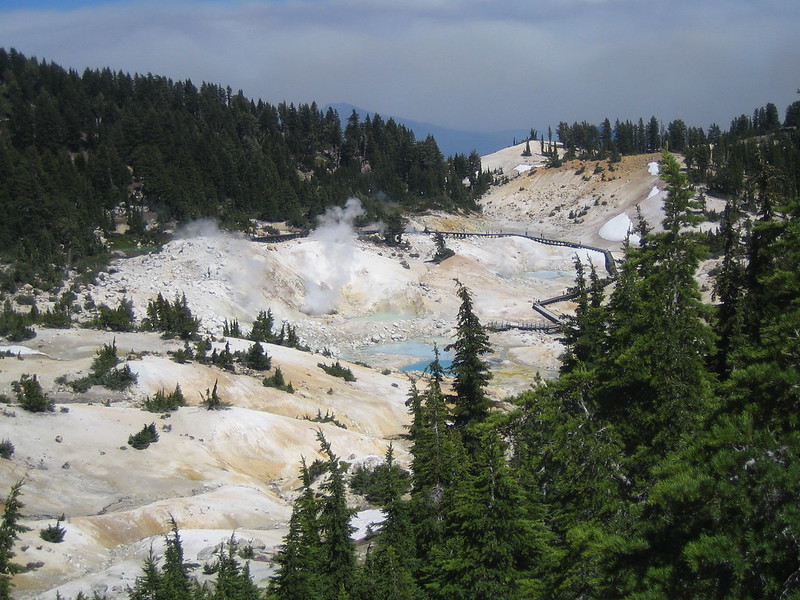
The Bumpus Hell Trail leads again down from the park road into an area with geothermal activity. This is one of the most popular hikes in the park. In the summer months, it can be difficult to park here because of the area’s popularity. If you have time for only one hike and are in decent physical shape, this hike is one of the ones that is most often recommended. You hike down the hill to a series of boardwalks that you can use to safely navigate the area.
Sulfur Works
For a quick view of the geothermal activity at Lassen with only a very short walk, you can park at sulfur Works and walk a short distance to an area with that pungent sulfur smell and bubbling mud pots.
Geothermal Activity
Lassen is an area with active geothermal features, especially at Bumpus hell, Sulfur Works, Devils Kitchen, Boiling Springs Lake, and terminal geyser. The first two of these are right off the main park road while the ladder three are in the Warner Valley area in the eastern part of the park. To visit these it’s better to have more than one day to visit the park. As with any geothermal area, it is very dangerous to wander off the boardwalks.
I have been wanting to get back to Lassen Volcanic National Park for some time. While my last visit was memorable, I was only five years old. When I was five, we visited Devil’s Kitchen. I quite clearly remember that my brother turned to my father as we stood in front of mud pots in front of a boiling lake and asked a simple question. “Can this ever turn into a volcano?” My father said he wasn’t sure. I don’t know the name of the foreman of the construction crew up on a nearby hill who decided that this was a good time to set off a dynamite explosion, but my parents said if they have not grabbed us my brother and I would still be running to this day.

McArthur-Burney Falls
Podcast
To learn more about Lassen, listen to Travel to Lassen National Park, California – Amateur TravelerEpisode 422
Day Two – 5 Waterfall Loop
On the second day of our trip, we took the 5 Waterfall loop that takes you to McArthur-Burney Falls and 4 other lesser-known waterfalls in the area. This took most of the day but was a relaxing drive in a loop heading northeast and then looping around counterclockwise and coming back to Redding again from the north over Shasta Lake.
McArthur-Burney Falls Memorial State Park
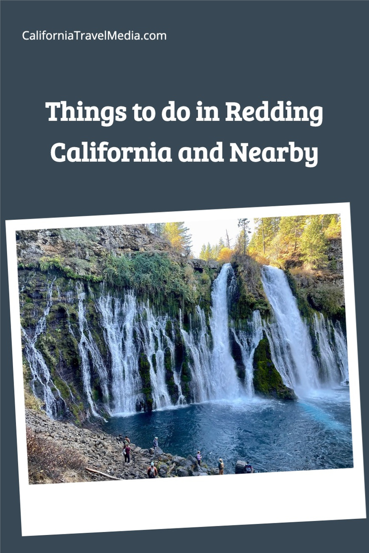
President Theodore Roosevelt called McArthur-Burney Falls the “Eighth Wonder of the World” and while I think perhaps the president needed to get out more, this is a beautiful waterfall in a small state park. One of the unusual things about the appearance of McArthur-Burney Falls is that the water not only flows over a rock wall, but also through it so that it is not one large torrent of water, but rather one hundred smaller ones.
There is a path that will take you down to the base of the falls, which you absolutely should take. From there the path loops around crossing the river downstream and then recrossing it upstream from the falls. We enjoyed that part of the hike, but do be aware that you will get no better views of the falls by taking the loop trail past the base of the waterfall. You will get within a tenth of a mile from the Pacific Crest Trail again on the loop trail.
McCloud River Falls
McCloud River Falls is not one but three distinct waterfalls which are imaginatively named Lower, Middle, and Upper McCloud River Falls. They are all in US Forest Service land 5 mi east of McCloud, California, and quite near to Mt Shasta, which is the second volcano of the trip. The 3 waterfalls are far enough apart that we drove between them. Each has a parking area and a short walk to view the falls.

Upper McCloud River Falls
Upper McCloud Falls is a small 25-foot high waterfall in a narrow place in a canyon. It is small but scenic. The overlook and the trail don’t get all that close to the waterfall.

Middle McCloud River Falls
Middle Falls is the largest of the 3 McCloud River waterfalls. It is around 50 feet high and 100 feet across. There is a trail to the right to see the fall from the river level.

Lower McCloud River Falls
Lower McCloud River Falls is both the least impressive waterfall of the three and the most popular. With only a 15 foot drop, this is the shortest waterfall of the 5 on the Waterfall Loop, but it drops into a deep pool which is popular for swimming. Even in October when fewer people were swimming you can see that a number of people were sunning themselves on the rocks in the area.

Yaks on the 5
Redding Tourism recommended (and treated us to) to a stop at Yaks on the 5 in Dunsmuir for lunch which is, as you may have guessed, just off of Highway 5. Yaks offers a combination of coffee, burgers, sticky buns & craft brews. Yaks was voted A “Top 100 Restaurants in America†by Yelp.
My wife and I split the Better than Blue Cheese Salad and the OMG! Burger. Both were fabulous! My wife tried the Trout Slayer Wheat Ale which she quite enjoyed. It is a popular beer with the local fisherman because the beer tap handle has a fish on it.
- Search for Great Tours HERE
- Get a San Diego CityPass to save on the 5 best attractions.
- Buy Travel Insurance
- Get a Car Rental
- Book Your Accommodation HERE

When they learned I was a travel writer they insisted that we try their famous cinnamon buns. Now I like a good cinnamon bun but let’s face it they usually taste a lot like bread. These cinnamon buns are so sticky they are almost more like a bread pudding. We cut one in 4 pieces and ate it with a fork as dessert for 2 meals. The next day we got within a 45-minute drive of Yaks and I seriously considered how far one can drive for a cinnamon bun before it becomes ridiculous.
COVID-19: While the staff wore face masks that were in no way effective, the restaurant has a great large outdoor seating space in the back with picnic tables.

Hedge Creek Falls
The final falls of the Waterfall Loop are just up the street from Yaks in Dunsmuir. Hedge Creek Falls is in a local park. Park along the road and walk down .7 miles to the falls which are small falls at the mouth of a cave. You can walk behind the waterfall. You can also continue on past the waterfall to an area with a view of the Sacremento River.
Day Three – Lake Shasta Caverns National Natural Landmark
The last site that we went to on our short three-day trip was Lake Shasta Caverns National Natural Landmark. Lake Shasta Caverns is only about 23 minutes north of Redding on Highway 5… sort of. The visitor center for Lake Shasta Caverns and the cave entrance are across the lake from one another.

The first part of your trip includes crossing over Shasta Lake on a boat which is part of your excursion ticket. After crossing the lake you will board a bus for a drive up the side of the mountain to the cave entrance. There are some beautiful vistas of the lake along the drive and from the cave entrance.
Lake Shasta is a man-made lake and it is used for irrigation. That means the water level in the lake changes quite a lot from spring until fall. When we went there in October, the lake level is about 100 feet lower than it would be earlier in the year. We were told that is pretty typical for that time of year.

As you are crossing over Shasta Lake, you’re actually cruising over one of the towns, Baird, that was submerged when the lake was created. Baird California had one of the first fish hatcheries on the west coast and it was a federal fisheries employee and Wintu Amerindian, James A. Richardson, who first “discovered” the caverns and entered on November 11, 1878. The story goes that Richardson was tracking a bobcat that had become overly interested in the fish in the fish hatchery when he came upon the caverns. You can still see his signature on the side of the cave interior that he wrote with the soot from his carbide lamp.
If you visit the cave today, you will enter further down the mountain in a different entrance that was created by a group of investors (Mrs. Tucker and the Thompson brothers) who took over the caverns in 1955. They were trying to dig their way to the lowest level of the caverns to a room known as the Basement but came upon a more interesting room called the Discovery Room which is where your tour will start.

You will start your visit from the bottom of the cave (below the “Basement” and work your way up the cave over your tour. I was really surprised how many stairs we had climbed during our tour as we took the steps back down to the entrance. If you can’t do a couple of hundred steps then this is not really a visit you will be able to do.
The cave is reasonably dry in October but in wetter seasons rain gear might be appropriate for visiting the caverns. Check with the visitor’s center before your tour.
The last room of the cave, shown above, is the largest and most impressive.
The tours are guided by knowledgeable guides who can point out all the different structures include stalactites, stalagmites, soda straws, flowstone, cave drapery, cave bacon, and the like. They can also point out the more imaginative features of the cave such as a rock that looks like Darth Vader, etc. The tour really was a lot of fun.
COVID-19: We visited in 2020 in the middle of the COVID-19 pandemic. All visitors were required to wear masks, but none of the tour staff, bus drivers, or boat drivers wore masks. Since the rate of infection of Shasta County is 5x higher than what we have where I live, this made me uncomfortable and I don’t know that I can recommend visiting until the pandemic is over.
Redding

Redding Sites
Our 3 days in the area did not give us a lot of time to explore Redding. We watched the sunset from the beautiful Sundial Pedestrian Bridge over the Sacramento River. The bridge is in the 300-acre Turtle Bay Exploration Park which we did not really get a chance to explore on this trip. Turtle Bay includes a museum, arboretum, and botanical gardens. The museum is a tad eclectic, with exhibits about art, science, history, forestry, and horticulture.
I would have loved to have visited Shasta State Historic Park but it was closed at the time of our visit in 2020 as were the Shasta Dam tours and Castle Crags State Park (more specifically Castle Crags State Park was closed to vehicle access).
Downtown Redding is a bit of a work-in-progress right now as they are doing a major $300M revitalization project. Much of the downtown will be under construction for the next couple of years, but I am told the results will be worth the wait.
Accommodation
There are a number of inexpensive hotels to stay at in Redding. We stayed at the Fairfield Inn & Suites Redding (Click here to check the latest price) which worked well for us.
Food
CIVID-19: We walked away from at least one restaurant bar downtown because it did not appear to me that they were meeting any of the state mandates for social distancing etc.

Mosaic
We ate at Mosaic next to the Sheraton Redding Hotel at the Sundial Bridge at the Turtle Bay Exploration Park. The restaurant has lovely outdoor dining areas in front and behind.

We ordered one of their pizzas which was quite good. The menu goes more upscale from there with entrées like Shrimp Scampi, Salmon, and Short Ribs.

Woody’s Brewing Company
We ate at Woody’s Brewing Company downtown taking advantage of their outdoor dining. My wife tried a flight of their beer and we split Asian Chicken Salad, Tator Tots topped with Garlic, Bacon, and Blue Cheese, and a Spicey California Chicken Sandwich with a side of their Mac and Cheese. It would have been just the right amount of food… if we had brought 6 more people. Even if we had just down the sandwich and the salad we would have had at least 2 meals worth of great food.

Conclusion
This was a great trip. I was just amazed at what we could see in just 2 and a half days of sightseeing. Redding is about a 4-hour drive from the San Francisco Bay Area and frankly, I don’t understand why we did not get there until this year. There would easily be enough to see, at least in a normal year, for a week-long trip. While I was a tad concerned with how they were dealing with COVID, I was definitely left with the impression that this area is under-rated.
 Â
 
Some of this trip was paid for by Redding Tourism, namely the meals mentioned at Yaks, Mosiac, and Woody’s and the entrance admission for Shasta Lake Caverns. All the opinions are mine.


